About Newton HeightsThe outline of the Newton Heights neighborhood flows along the southern side of Bunker Hill Avenue from the Watertown town line eastward to the intersection of Irvington Avenue, then northward to Watertown Avenue, southeasterly to East Aurora Street, then northeastward to Steel Brook, and again southeasterly to the James H. Darcey Memorial Highway; it then continues to the intersection of Robbins Street, then to the intersection of Grandview Avenue, then Westwood Avenue, then to Westmont Drive, then nearly due south along Parklawn Drive, the following the power line to just past Wayridge Circle, then nearly dissecting Western Hills Golf Course straight through to Park Road, and heading roughly west to the town line, and finally (not following any roadways) back to Bunker Hill Avenue at the intersection of Bunker Hill Road. This description includes Heritage, which is, to some people at least, a neighborhood of its own.
The term "Newton Heights", as a neighborhood, has been more sparsely used in the past 100 years than in the previous decades. Colloquially, especially solely among residents of that neighborhood, is still being used, although rarely. Real Estate agents and some governmental references hold more fastly to the term "Newton Heights" than others. It is unlikely that the use of the term will every truly vanish, as a road in the neighborhood still carries the Newton name. Parks in Newton HeightsThere are no known parks in Newton Heights.
|
Contact Information30 Newton Terrace
Waterbury, CT 06708 (203) 757-9519 |
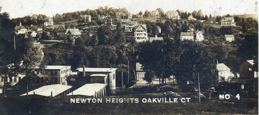
Once, not too long ago, the Newton Heights section of Oakville became the Newton Heights section of Waterbury. The deal was part of an exchange between the two municipalities, involving approximately the same land mass.
