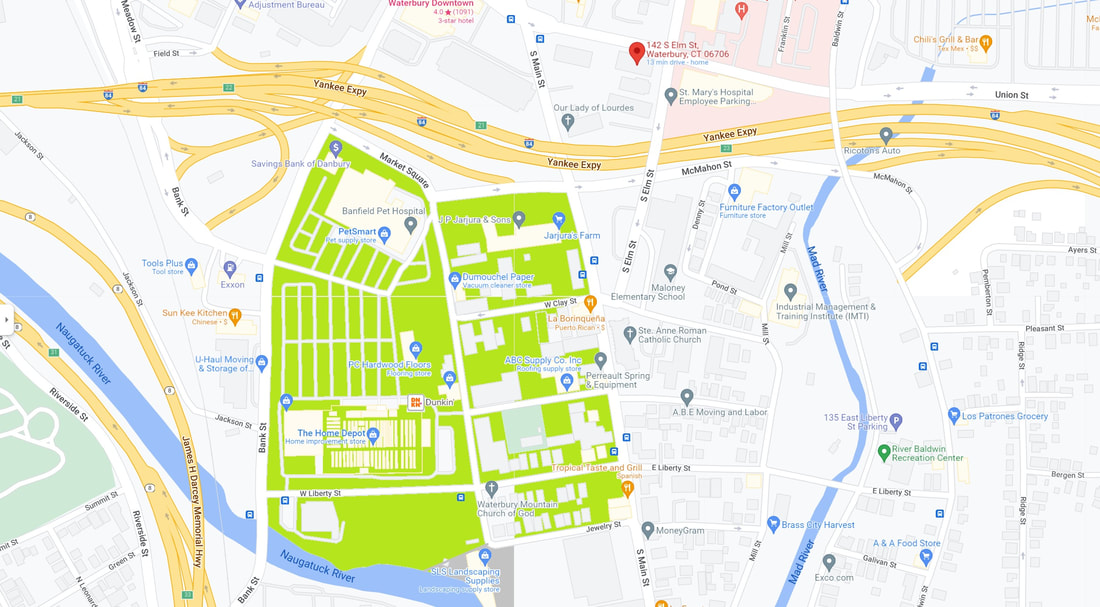
The map above, which is a modern-day Google Maps map of part of the City of Waterbury, depicts Pine Hill (shaded herein in a roughly bright green color). In an irony, Pine Hill is, more factually, a plain. It's a relatively low-lying area, and it is relatively level.
Waterbury, CT 06720 - Google Maps
Waterbury City Plan, Atlas: New Haven County 1868, Connecticut Historical Map (historicmapworks.com)
- At that time,
- Meadow Street continued past the current interstate highway through to South Main Street,
- Jewelry Street was Jewllers (yes, double-L) Street,
- Field Street continued from Grand Street to Riverside Street,
- Benedict Street didn't yet exist,
- our current Market Street was, roughly, still Meadow Street,
- Liberty, Clay, and Dover Streets connected Mill Street to South Main Street, and no further (it was only later that Liberty, Clay, and Dover Streets continued through to Benedict Street, and each had their East and West versions)
- Meadow Street continued past the current interstate highway through to South Main Street,
Waterbury, CT 06720 - Google Maps
Waterbury City Plan, Atlas: New Haven County 1868, Connecticut Historical Map (historicmapworks.com)
About Pine HillPine Hill may have been in the southern and central parts of Waterbury. A road with the same name, in 1700, ran from what was the end of Bank Street, near Meadow Street, south to Judd's Farm of the day, which is modern day Naugatuck.
Pine Hill Road may have been what is now the continuation of Bank Street, through Charles Street and onto South Leonard Street. Pine Hill is known to have a clear view of the old Saint Joseph's Cemetery. For all intents and purposes, Pine Hill is the Abrigado. Some sources indicate that Pine Hill is the current Washington Hill. To be precise, Pine Hill is a specific part of the greater Washington Hill neighborhood, and it is a neighborhood of it's own rite. Pine Hill became Holy Land U.S.A. Pine Hill was in fact so-named due to the excessive amounts of very tall pine trees which were abundant there, up until at least the 1930s. At the very top of Pine Hill was Duck's Pond. The pond was used for rafting and for ice skating, seasonally. |
Did Anyone From Pine Hill Ever Become Famous?We don't know.
|

