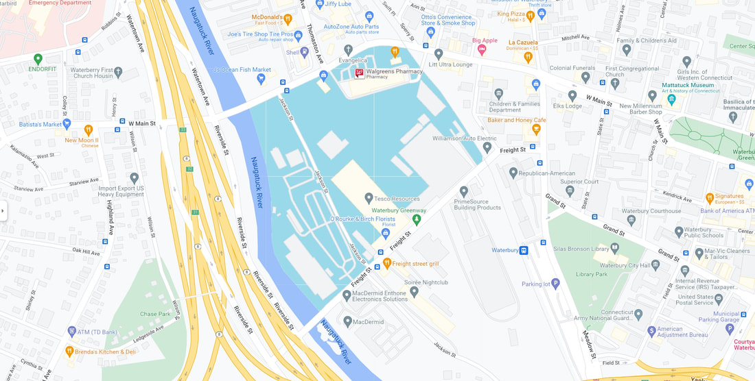
River Side Hill
The map above, which is a modern-day Google Maps map of part of the City of Waterbury, depicts River Side Hill (shaded herein in a roughly turquois color). In an irony, River Side Hill is, more factually, a plain. It's a relatively low-lying area, and it is relatively level.
The "hill" was designated as such during a time when our current Riverside was not yet adjoined, as River Side. It was also during a time when both Wilson Street and Riverside (yes, one word) Street connected directly to West Main Street, and when Field Street connected Grand Street to River Side (yes, two words) Cemetery. Also back then, the cemetery extended westward past Draher Street, through Alders Street, and abutted Wilson Street. Wolcott Street, at that time, was actually Wolcott Road. Bank Street, at that time, ended before Riverside Street; what is now the continuation of Bank Street was then Town Plot Road.
Waterbury, CT 06720 - Google Maps
Waterbury City Plan, Atlas: New Haven County 1868, Connecticut Historical Map (historicmapworks.com)
